When Brigham Young and the gang arrived at the current site of Salt Lake City, he and some others climbed up on a hill that is north of the current downtown, looked out over the basin and planned their city. Today there's a trail that leads up to the peak, and the short hike is recommended as a good one to do at dusk to see the lights come on in the city below. So, that's what I did.
These first few are taken on the way up:
Here you go: Salt Lake City. I'm not sure if this is what the original settlers envisioned, but this is how it looks now. The state capitol is slightly left of centre in the middle ground, with downtown behind it.
There were some cool clouds as the sun went down:
... and now the lights are coming on.
Wednesday, November 16, 2011
Friday, November 11, 2011
Donut Falls
This is a popular hike trail in Big Cottonwood Canyon, southwest of Salt Lake City. The trail scenery wasn't breathtaking, but it was nice to be out in the woods, in the fall, in the mountains. Photos are from Oct. 22.
Below is the waterfall- you can see people climbing beside it. Near the top the water enters a round opening and comes out below, that is the "donut", but you couldn't see it that well and can't see it that well in the photo either. Nice waterfall all the same though.
After the waterfall we drove a little higher and further into the canyon, so I'll post the rest of those photos soon.
Oh, and just to note, it's 11/11/11 as I post this... just look at all those 1's! Try to ignore the "20" that is being omitted from one of them, and party like it's 1111...
Below is the waterfall- you can see people climbing beside it. Near the top the water enters a round opening and comes out below, that is the "donut", but you couldn't see it that well and can't see it that well in the photo either. Nice waterfall all the same though.
After the waterfall we drove a little higher and further into the canyon, so I'll post the rest of those photos soon.
Oh, and just to note, it's 11/11/11 as I post this... just look at all those 1's! Try to ignore the "20" that is being omitted from one of them, and party like it's 1111...
Tuesday, November 8, 2011
Big Cottonwood Canyon, Utah
Hop in! The drive from downtown Salt Lake City into Big Cottonwood Canyon, which is about 12 miles southwest, was amazing. I love mountains, and this trip had mountains-a-plenty. I was a passenger for this drive, so I could be trigger-happy on the camera shutter.
Heading west on I-80:
South on I-215, along the eastern edge of the city:
I think we're on Wasatch Blvd. here:
OK, we have turned east into the canyon... now up and up and up and up, and the mountains change around every turn...
Some nice fall colour:
Further up, lots of leaves are off the trees already:
South on I-215, along the eastern edge of the city:
I think we're on Wasatch Blvd. here:
OK, we have turned east into the canyon... now up and up and up and up, and the mountains change around every turn...
Some nice fall colour:
Further up, lots of leaves are off the trees already:
... and we arrive at our hiking destination, Donut Falls. Don't go away, photos of that are coming up next...
Saturday, November 5, 2011
Frary Peak trail and Dooly Knob
We headed over to the east side of Antelope Island a little late in the day to do the planned hike of Frary Peak. There was a side trail to "Dooly Knob" that was shorter, so we took that instead. It still gave us great views. I'll restrain myself and show you just a few photos.
Here's a look over the water at some of the Wasatch Mountains which run to the east of Salt Lake City, stretching north and south of the city too:
Here's a view from near the top of the "knob", looking northwest at Great Salt Lake:
Just some rocks near the top of the hike:
Next up will be a trip into the mountains in Big Cottonwood Canyon, to the southeast of Salt Lake City, so don't go far...
Here's a look over the water at some of the Wasatch Mountains which run to the east of Salt Lake City, stretching north and south of the city too:
Here's a view from near the top of the "knob", looking northwest at Great Salt Lake:
Just some rocks near the top of the hike:
Next up will be a trip into the mountains in Big Cottonwood Canyon, to the southeast of Salt Lake City, so don't go far...
Wednesday, November 2, 2011
Great Salt Lake and Antelope Island
There's a state park on Antelope Island in Great Salt Lake. I've always wanted to see the lake, so I thought that would be a good place to head to get up close to it and do some hiking too.
To get there, you drive north of Salt Lake City for around 40 miles, and there is a causeway that takes you out to the island in the lake:
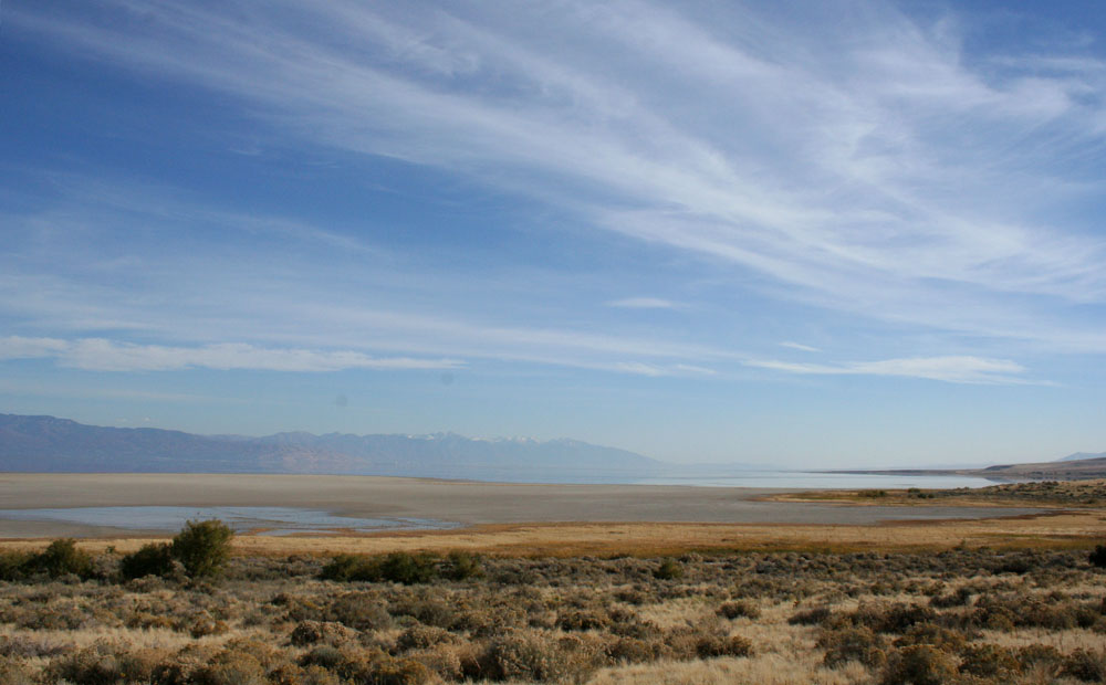
There are some places to stop on the west side of the island and hike short trails to get some views of the lake and the landscape:
This buffalo statue is at the visitor's centre. They introduced buffalo to the island in the late 1800's and they still graze on the island, although they round them up in winter and put them in pens.
A view back at the causeway and the mainland from the visitor centre:
Next stop, the beach, to have a taste of the lake. Verdict: really salty!
Beach sand:
These next photos are from another short trail where you can hike up on a bluff over the water:
Look... buffalo! Saw these on the drive to the other side of the island.
I'll have more photos from a hike on the east side of the island, coming up soon...
To get there, you drive north of Salt Lake City for around 40 miles, and there is a causeway that takes you out to the island in the lake:
There are some places to stop on the west side of the island and hike short trails to get some views of the lake and the landscape:
This buffalo statue is at the visitor's centre. They introduced buffalo to the island in the late 1800's and they still graze on the island, although they round them up in winter and put them in pens.
A view back at the causeway and the mainland from the visitor centre:
Next stop, the beach, to have a taste of the lake. Verdict: really salty!
Beach sand:
These next photos are from another short trail where you can hike up on a bluff over the water:
Look... buffalo! Saw these on the drive to the other side of the island.
I'll have more photos from a hike on the east side of the island, coming up soon...
Subscribe to:
Posts (Atom)