Showing posts with label Northwest Territories. Show all posts

Thursday, November 7, 2019

A stop in Inuvik, and home to Ottawa

Due to flight schedules, I had to overnight in Inuvik on September 10.  I took just a few photos while out on my walk that evening.  Here is the iconic igloo church:


Downtown Inuvik:


Home Hardware, on the outskirts of town:


The polar bear at the airport.  He looks kind of surprised or frightened:


I had to overnight in Edmonton.  I stayed at the airport Renaissance hotel, here is a photo from my window of the front of the terminal:


These 5 photos are from my flight home to Ottawa on September 12.  These fields are just east of Edmonton:


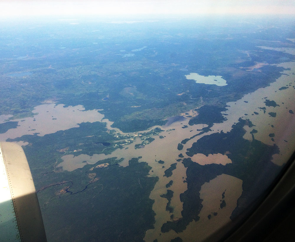
Over the prairies we had cloudy skies almost until we were over Ontario.  Here are some lakes in northwestern Ontario:


Meech Lake in Gatineau Park, just north of Ottawa:


Here's Ottawa.  We're still so high in altitude, and it's such a clear day, that a lot of the city is visible in this one:


Mud Lake and Britannia Beach, as we flew over the Ottawa river.  My old apartment building is in that cluster of high-rises in the upper left part of the photo.


This is the Rideau River as we are about to land from the west:


That concludes my short trip to the NWT.  I hope to go back, I liked working there.

Wednesday, November 6, 2019

Sachs Harbour

It's taken me a while to get back here to post my photos, but I did eventually make it to Sachs Harbour.  I was there in early September.  The weather was beautiful while I was there ... until the day I was to leave of course, and then the fog came in.

The photos are all taken between Sept 2 and 10, 2019.  The first is of the east end of town:


This is the cemetery:


East end of town again, from a slightly different angle:


These were taken around noon at the end of Mary Sachs road, which runs around 4 km west of town and ends up at the beach.  The first 2 photos are of a tidal pond, the one after is the beach itself out that way:


These were taken from the beach in front of town:


I don't know the history of this building, but it's at the western edge of town, looks like it was a museum at some point, maybe for cruise ship passengers:


These last two were taken on take-off as I headed back to Inuvik on my way home:


Tuesday, November 5, 2019

Fort McPherson

Thought I would post a couple more photos from my time in Fort McPherson.  These are from the end of August.

A couple of signs on the Dempster Highway:


Lakes just north of town:


A small cemetery, not the main one:


View of the mountains from my apartment, during a rare patch of sunshine:


And I couldn't resist taking a couple more photos of the church at Tsiigehtchic, as the taxi back to Inuvik crossed the Mackenzie river on Sept. 2:


Monday, September 9, 2019

Diverted to Fort McPherson

On August 29 I flew north from Edmonton, destination Sachs Harbour.  I didn't have a window seat until we got past Yellowknife and to Norman Wells, NWT.

Here is my plane parked at Norman Wells during the stop there:


It was overcast for pretty much the whole flight.  When we came out of the clouds on approach to Inuvik, I got this photo of the tundra and lakes of the Mackenzie Delta area, where the vegetation is transitioning from boreal forest to tundra around the treeline:


When I went to the Aklak Air counter to check in for my flight to Sachs Harbour, they told me my flight had been cancelled.  They waved me into a back office where someone from the regional travel department told me that I was being sent to Fort McPherson instead, as they had an urgent need there.  Another nurse who had also been diverted to go there met up with me at the airport, and we hopped into a cab to go to the Inuvik hospital, to get more info.


After 90 minutes or so there, another cab came and picked us up to take us to Fort McPherson, which is a 2.5 hour drive south on the Dempster Highway, which is famous with RV drivers who can drive to the arctic ocean (the road ends at Tuktoyaktuk).

Here we are crossing the Rainbow River:


Just a photo taken from the back seat as we drove.  It's obviously peak yellow season with the fall colours.


Here we are descending into the Mackenzie River valley, to get on the ferry across it.


The ferry ride was short but fun:


Banks of the Mackenzie River as we crossed on the ferry:


This is the community of Tsiigehtchic, where the ferry docks on the other side:


This is the Dempster Highway at the turn into Fort McPherson, which I am standing on, I took this photo that evening on a walk.  The highway is curving off southward at the right of the photo.