
We loved Wurzburg, we were there November 28, 2022.
Here is the view we opened the cabin curtains to that morning:


The included excursion was a tour of the Bishop's Residence. Lucky for you, they do not allow photos inside! Here's a view of part of the outside:


Garden gates at the residence, that is Ed at the far left:

After the Bishop's Residence (which was stunningly spectacular, those religious folks didn't follow the vow of poverty too closely back in the day), our guide led us down the hill into town for a walking tour.


Here is our tour guide explaining one of the sculptures outside the modern art museum. Since it was exactly 8 months ago today, I have forgotten what it's about, something important and historical I think though:

I think this is the opera hall:


Yes, it's another ... Christmas market!


This stone work has a depiction of god blowing (I think?), with a straw-like thing, the baby Jesus into Mary's ear:


That's pigeon netting over the stone sculpture.


There's the odd modern building sprinkled in here and there in the old town:


A very curved road at the entrance to the bridge:


This is an old wine bar on the bridge:

View of the old Bishop's fortress (Marienberg Fortress) across the river:


Side view of the wine restaurant:


From the bridge, looking back into town:

Ed with the bridge in the background:

We were looking at this old Bishop's fortress, and figured that after lunch we would climb the hill to find it and see the views from up there:


After lunch, we took a couple of photos of the stateroom. It was pretty small, but we loved the french balcony, where we could easily watch the scenery glide by if we were cruising during the day while we were in the room:

The tiny but functional bathroom:

Back on the bridge, crossing over to go climb the fortress hill:


On the other side of the bridge:

Up a side street to find the fortress:

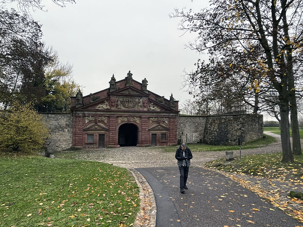
Entering the fortress grounds:


Crossing the first moat:

Through the first tunnel of fortification:


Passing through the park just past the first wall of fortification:

Heading into the tunnel through the second wall:


Up the ramp to the first courtyard:

This must have been a guard house back when the fortress was operational:

Heading towards the third wall (this place is really fortified!)

Looking behind us as we approach that third wall:

Into a fortified courtyard. There is a museum here but we don't have time to visit it (all our cruise stops were so quick, not a lot of time to soak up museum culture.)


Crossing another moat, into the final inner courtyard of the fortress:

Some views before we cross through:


Saw this tower as we entered the final inner courtyard:
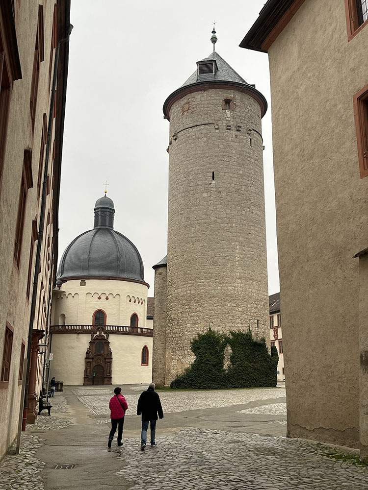
Looking back where we just passed through:


We could go through a chapel entrance and see it through a glass barrier:

Inside the tower:


A passageway:


A different view of the innermost moat:


Finally, we found what we climbed the hill for (not that we were complaining about the unexpected free access to the fortress!):


Yes, that's our ship! Ours is the one past the bridge:


Just below us on the slope is a vinyard:

Looking back up at the fortress:


Another passage:

Then we walked back into town to go to the grocery store to get some beer for Ed and snacks for us both:


