Monday, January 31, 2011

Japanese mushrooms

When I stopped by the Japanese grocery store a few days ago to pick up some noodles, I found something else new and wonderful to try:


I just love mushrooms, so finding new ones is always so much fun.  I didn't know what to do with these beech (top photos) and enoki (bottom) mushrooms, so I just cut them apart and stir-fried them with butter.  Delicious.  The enokis I separated into individual "sticks" so that they kind of sauteed into a noodle-like consistency.  A few days later I had them at a Japanese BBQ place and they kept them in clumps.  I liked them both ways, but separated into "noodles" was pretty interesting, they had the mouth feel of a firm noodle but a wonderful mushroomy flavour.

They weren't even expensive, less than $2 for each package.  I'll definitely buy them again.

Thursday, January 27, 2011

Up through the ground came a bubblin' crude

The area I live in used to be covered in oil wells until the 1940's or so.  Just south of where I live there is an open tar pit, the La Brea tar pit, which I visited last year.

I'd heard that sometimes oil bubbles out to the surface around the neighborhood, but I'd never seen it before.  This is a sidewalk on Curson Ave., near the tar pits, in mid-January.  It's actively oozing:


This one below was recently oozing, you can see a soft spot at the upper left.  It's at the intersection of Curson and Wilshire:


Jed Clampett would feel right at home.

Monday, January 24, 2011

The Apple Police

I had no idea what this was about the first time I drove up to one of these agricultural checkpoints on entering California.  I'd already been grilled at the U.S. border... surely they weren't going to put me through a secondary set of hoops to get into California?


Well, kinda!  These were relatively easy hoops though, they want to know what fruits and vegetables and plant material I had in the car.

The first time, since I hadn't been expecting this, I had my fruit, some apples from a hotel breakfast, tucked away with my clothing in a rubbermaid tub (the official suitcase of the north is also great for car travel).  It was on the back seat, so the agent (who was really friendly, and impressed that I had driven all the way from Ontario) cheerfully rifled through my underwear to find them, and approve that they were indeed a suitable apple for import to California.

The next time I went through a checkpoint on the way home from Vegas, I had some apples that I had brought with me from L.A. to eat on the trip (Vegas food is expensive... gotta have a grocery stash).  This agent studied the apples much harder, despite my reassurances that they had originated in California, but eventually passed them back to me so that they could return to their neighborhood of origin.

This makes me sooooo curious... what does an illicit apple look like?  Are they the secret hallucinogenic apples?  Explosive apples?  Apples not yet approved by the F.D.A?  Really good apples that the agents like to confiscate for lunch?  I mean, I get that they are trying to stop foreign pest invasions, but apples tend to come from harmless countries.  Considering they all arrive by automobile at these checkpoints, it practically guarantees a North American purchase, or at least previous American border scrutiny.  Where is the illegal apple gateway?

Well, wherever it is, there's a loophole.  On my last re-entry to California after the most recent Vegas expedition, traffic was heavy, so the agents were just smiling and waving the cars through.

Did I have contraband apples with me?  The state of California will never know.  Actually, neither will I.

Saturday, January 22, 2011

The Road Runner Cactus

These don't grow just anywhere in the desert, you know.  Those iconic cactuses that you see in the cartoons?  They're Saguaros, and they grow in the Sonoran Desert.  We passed through part of this desert north and west of Phoenix.

These are at a rest stop west of Phoenix.


Supposedly they can take up to 75 years to grow any side arms.


They sometimes are lined up on a ridge of a mountain, but I didn't get any pictures of that (cloudy weather, plus I did most of the driving through Saguaro country).

Tuesday, January 18, 2011

The contender

The annual Nunie blogging awards, which feature the bloggers of Nunavut, are now in the voting phase.  My post from last November about Oprah skypeing into Grise Fiord is one of the entries in the "Best Blog Post" category.   I'd like to gush about how it's an honour just to be nominated, but the truth is, in this category, bloggers nominate one of their own posts.

If you want to have a look, here's a link to the Nunies blogging awards page.  My category is down at the bottom of the page.

And if anyone has surfed here for the first time from the awards page, welcome!  If you want to check out some of my other Nunavut posts, just follow the "Nunavut" link in the categories list at the bottom of the sidebar.  See you again I hope!

Monday, January 17, 2011

The new bridge at Hoover Dam

On our way to Phoenix, we crossed the Colorado river at the Hoover Dam.  This used to involve driving across the dam itself.  A couple of months ago, they opened a new bridge and diverted the highway onto it and off the dam.  They installed a pedestrian walkway on the bridge so that people could cross on foot to view the dam.

This is on the approach to Lake Mead, which is the reservoir behind the Hoover dam.


This is where we should have exited, but from the research I'd done, it made it sound like the parking lot for the bridge walkway is right beside the bridge.  We didn't want to go to the dam itself, so we kept driving.


From a passenger car you can't even tell you are on the bridge when you cross it, but we did clue in once we were in Arizona that we'd missed it!  It was easy to turn around though and go back.

This is the pedestrian walkway, heading south from the Nevada side


Great view of the dam, eh?  It's huge- I pasted two photos together in this next photo:


Another look from further down the bridge.  The reservoir was at it's lowest level since the dam was being finished in 1937.

There are several interpretive panels about the bridge construction along the walkway, this is one of them:


Here's the state line on the walkway, you can see my toes at the bottom.  Right foot in Arizona, left in Nevada.


View back along the bridge from the Arizona side.


I liked these leaning towers of Hoover on the sides of the gorge:


I can't imagine how they lived for so many decades without this bridge.  Supposedly traffic would get really congested as everyone waited to cross the dam itself.  I'm really glad they took the opportunity to put in a viewing walkway too.  The Hoover Dam is one of those iconic American symbols that everyone seems to go see at some point, and now from this bridge, they can see it really well.

Friday, January 14, 2011

Turtlehead Peak, part 2

Some more rocks on the way up, and some more peeks at the peak:


I thought this one looked a bit like an elephant:


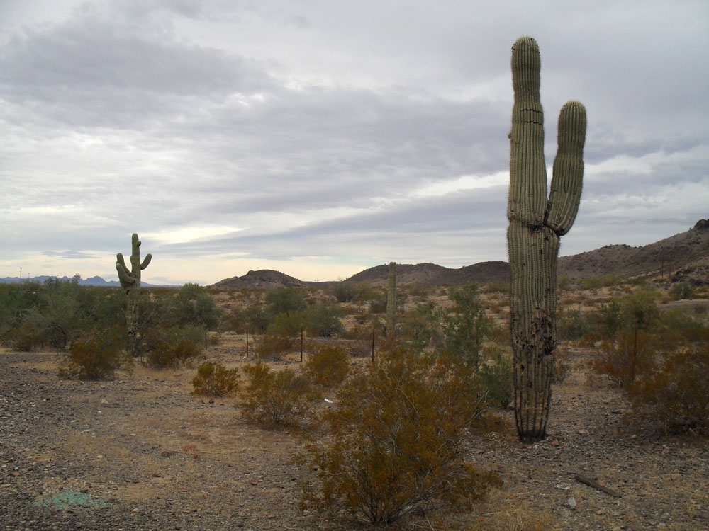
At around the halfway point, the landscape became more like this:


Looking back.  That's another gravel wash coming down off the mountain.


This below is a little before the spot where we lost the trail and had to turn around.  We met some other hikers coming down off the peak, and they said we'd make it (we had better shoes, poles etc), but the trail basically went missing, it was getting late in the day, and as you will see in later pics, the sky was getting really threatening!  Not good conditions to go scrambling over pointy rocks and have to come off the mountain in lower light.  Plus, these gravel washes in the desert are at risk of flash flooding, and I didn't know this landscape well enough to be sure we'd be OK if that sky opened up and started raining as heavily as it looked it might.


That's one thing about Red Rocks Canyon park- it's really hard to stay on their trails.  They're not well marked, sometimes not marked at all after the trailhead, and because they are so hard to find, the trails of previous hikers form a delta of tributary trails, all of which eventually come to dead ends.  We just couldn't find the trail that went for the peak, and conditions weren't good enough to scramble over cliffs and boulders.

I didn't take too many photos up around the un-summit, as it was too dark and closed in.

I liked some of the views on the way down though...


We did a little side hike too on the way down and climbed one of the rock hills.  Look at that sky... now does that look like a desert sky to you?


So, a bit of a disappointment, but we still got some amazing views, and with all the cloud, we might not have had the 360 degree view at the top of Turtlehead that we were hoping for.

Next stop... Hoover Dam!  They built a new bridge there, did you hear about it?

Wednesday, January 12, 2011

Turtlehead Peak, part 1

I think it was Dec. 15 when I did this hike.  I took a lot of pictures, so here are the ones I have gone through so far.

The weather was very overcast, and even spit rain earlier in the day.  I seem to hit deserts on their few rainy days.  Made for interesting photos though- you could see more detail in the rocks and mountains than you do in bright sunlight.

That's Turtlehead peak in the middle of the photo below.  That's where we're going hiking.  This is taken from the road approaching the park.  This is just a few miles from the northwestern corner of Las Vegas.


The scenic road inside the park.  Turtlehead peak is seen in the distance.


I just love the red curvy rocks of Red Rock Canyon.  I never get tired of looking at them.  The grey-blue skies contrasted nicely.


You can see the peak peeking out...


More rock photos, sorry, it can't be helped...


The tops of some mountains were in the clouds today.


Not Turtlehead peak, though, it was just underneath the cloud cover.


These are the mountains on the other side of the canyon.  Great view of them today; on a more typical sunny day they are so shadowed you can't see their colours well.


That's a gravel wash in the foreground:


There were trees here and there in sheltered areas:


A little further up the wash:


Looking back along the trail:


A yucca plant.  There were quite a few of these along the trail.


More pictures to come as I go through them.  I take so many photos, but I just love desert landscapes.