Wednesday, September 15, 2010

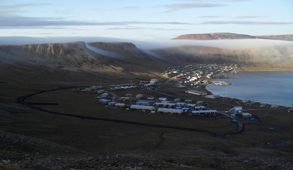
Red light in Adams Sound


I think I took around 60 photos of this to try to get a good one, and this was the best I could do.  (My SLR camera was back in Ottawa, I was using a cheapie digital).  This is from September 1, from the apartment window.  The DPW really needs to move those power lines!  ;-)

As the sun was retreating behind the mountains, Adams Sound lit up red in the fog or drizzle behind Holy Cross Point.  It lasted for at least 10 minutes or so, and behind the pole there was a rainbow that was tinted red.  I know you'll believe me when I say the photo doesn't do it justice.

Monday, September 13, 2010

Iceberg

As I came back from my walk on August 24, look what came sneaking around the corner of Uluksan point:


Saturday, September 11, 2010

Tsunami cloud


Out in Admirality Inlet, there is sometimes a low cloud or fog that blows up against the south end of Adams Sound and makes this tsunami-like effect.  This was taken August 17.

Friday, September 10, 2010

Back to Ottawa

I still have more Nunavut pictures to come, but I arrived home in Ottawa this past Tuesday.  It's always a little weird to be back in the land of hostile drivers and hustle and bustle (and Ottawa's not a terribly bustling place).

Here's that familiar view of the Ottawa river that you see to the east as the plane crosses from Quebec into Ottawa:


Here's what it looked like at the Nanisivik airport when I left:


What a difference a few thousand kilometres and almost 30 degrees of latitude makes.  ;-) 

I head back to the land of swimming pools and movie stars and unspeakably good weather in a couple of weeks.  In the meantime, I'll be running around getting ready for the next leg of the migration.  I'll keep posting Nunavut photos in the meantime though, so stay tuned...

Thursday, September 9, 2010

Tuesday, September 7, 2010

Little waterfall at Victor Bay

It was a rainy weekend, and that messed with my hiking plans!  I'd planned to hike to both Holy Cross Point and to a waterfall that is over near King George Mountain, but both of those tend to be wet hikes, including crossing a shallow creek to go to Holy Cross Point, and we'd had too much rain for me to be sure that those creeks I'd have to cross would be safe on foot.  It's a shame too, since this is the first weekend I've had where I wasn't on first or second call on either day for 6 weeks!

So, instead I headed over to Victor Bay on Sunday (when the rain let up for most of the day, unlike the washout that was Saturday), where I'd never walked along the beach there before.  I'll show you the beach in a later post.  For today, here is a little waterfall on a creek that I had to cross to get to the beach.  Even this little creek gave me trouble crossing it due to all the runoff from the rain, but I eventually found a spot.  There were lots of places where I was 95% sure I could leap from rock to rock without falling, but it's that 5% when hiking alone that is too big a risk- if I fell and broke something, I'd get hypothermic in the water long before anyone came looking for me.  Rocks are slippery when wet.

Here are some rapids burbling away on the land.  I don't know if the creek has a name.


Fall colours are out, have been for some time:


Here's the creek coming up to a bend where it enters the waterfall:


There it goes, in between that gap in the rocks:


Another view as it starts heading down:


Looking up at it from below.  There's nothing to show size, but the mini-canyon would be around maybe 20 feet in the deepest spots?  I'm not that good with estimates.


Here's the creek coming out onto the beach, and flowing into Victor Bay.


Stay tuned and I'll show you the beach pictures later on, when I have time to go through them.

Sunday, September 5, 2010

St. George's Society Cliffs

Here's a view of them on August 29 from the gravel-making area east of the new airport:


I think this is kind of a neat view of a piece of them from below- this part is a little gravel hill at the back of them, taken from behind and just east of them, on the hills soutwest of town.  I wouldn't have expected them to drop off like that at the back.

Friday, September 3, 2010

The endless march of progress

In July I did a "then and now" post comparing the new subdivision in 2006 with the way it looks in 2010.  It's changed again since then.  Another new road has been put in. 

Here's how it looked back on July 2:


And below is how it looked on August 23.  They started putting that big new road in at the end of July.


The new subdivision will soon be bigger than the historic district!  Although I am guessing it will take a few more years to fill up those new roads with houses.

Wednesday, September 1, 2010

Mushroom

At the top of the hill on my Marcil Creek hike, I came across this thing.  I thought, someone was playing golf all he way up here, with deformed balls!  It's a mushroom.  Haven't seen any like this before.  It was there all alone:

Monday, August 30, 2010

Marcil Creek

Marcil Creek feeds Marcil Lake, which is where our water comes from in Arctic Bay.  I'd seen it several times from first bridge, where the road between town and the Nanisivik airport crosses over the creek.  Yesterday, I drove out to first bridge on the ATV and went hiking up the creek.


I liked the mix of rounded and rough rocks at the side of the creek:


OK, around a corner and the creek heads east.  I climbed that hill on the right to get past this cliff area:


The next photos might look very similar, but I like the way they show the change in the creek as I make my way upstream:


These flat rocks were nice for walking on.  It other areas it was boulders:


Lots of rapids and little waterfalls the whole way:


Looking back the way I came:


I came to a spot where it was too steep at the water's edge to hike further along the creek, so I headed up a mountain to the south:


It gave a good view of this gravel cliff to the north.  I heard some rocks fall from it when I was on my way back.  There's nothing to show perspective, but this is very high and steep.


Looking east along the creek.  There's a tributary there to the north (left).


Here's a view to the west from the top (or thereabouts) of the hill I climbed.  That's the south side of Adams Sound at the upper left, Holy Cross Point below it, and the St. George's Society Cliffs at the upper right, with Marcil Creek flowing towards it.  Marcil Lake (where the water comes from) is below Holy Cross Point.  Quite a view!