Saturday, October 30, 2010
Humid sunset at Runyon Canyon
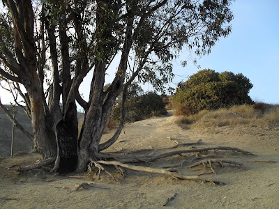
The day after I arrived, October 3, I went for a hike near sunset at Runyon Canyon. It's a park in the Hollywood Hills, a couple of miles north of where I live. It was humid that day- I like the effect I got from the moisture in the air in the above photo, as the sun was going down.
Here are a few more photos from my hike.
Pedestrian traffic over the years has worn the trail to deep grooves in some spots:
It was too humid for good views of the city, but I liked the light as the sun set.
Thursday, October 28, 2010
Desert rain
I don't know what it is with me and deserts, but I tend to get rained on when crossing them more than one might expect. It sure makes for some dramatic skies though.
So here are some pics from the drive down highway 40 towards Los Angeles. The landscape is sure not boring, and October 2, the skies weren't either.
Currently 448 miles east of Los Angeles, or so says the sign. It's around 500 miles I think from the Grand Canyon to Los Angeles. This was the longest day's drive of my trip.
Clouds starting to gather. I ran into rain, and even a thunderstorm in Kingman, Arizona (near the border with California.)
I think this is just east of Kingman. That's an anvil cloud, I think the best specimen I've ever seen. It was huge though, this is just a small part of it out the side window. Anvil clouds go with thunderstorms, which I'm guessing they don't get too many of in the desert around Kingman.
I didn't get many good photos during the rain, too dark and wet, although the landscapes I was passing through were beautiful and dramatic.
This must be after I turned south on to Interstate 15. Interstate 40 ends at 15. This must be going uphill as there is a truck lane on the right. Cool clouds, eh?
This is coming down through the mountains towards the eastern suburbs of L.A. This photo would still be around 75 km from the part of LA where I stay (which is sort of on the cusp of the west side, around 12 km east of the beach.).
... and from there on in, there was too much traffic to take any pictures. But I'll have some of my various activities and outings in LA soon.
Tuesday, October 26, 2010
The last of the Grand Canyon pictures, I promise!
OK, just a few more and then I'll take you down the road to Los Angeles, OK? These are of the eastern part of the park, out along Desert View drive.
I'm not the only one taking pictures of the Grand Canyon...
The weather was very changeable this day (October 1), every time I got out of the car to take a picture, see a sight or try a hike it started to rain. Still, I find the overcast conditions made it easier to see details lower in the canyon.
The photo below is of a spot in a bend in the Colorado river where Pueblo Indians used to have a camp or a small settlement, down at the bottom of the canyon:
Another view of the Colorado river down there, looking west:
Thunderstorms were all over the place:
I like the detail I could see in the following two pictures:
Skies were interesting and different from minute to minute:
More detail of the inner canyon- I love the patterns of the red layers!
This is at the Grandview trailhead, where I tried to take a short hike, but the rain started about 1 minute into it so I turned around.
I forget where this is, but it's a cool formation!
... and that, I swear, is the last of my Grand Canyon pictures. Until my next visit- I won't be going back right away, but at some point, definitely! I have unhiked trails and canyon floor to see up close yet.
Sunday, October 24, 2010
Tusayan ruins
In the eastern part of the Grand Canyon National park, there's a Pueblo Indian archeological site that dates back to 1200.
I overheard the guide who was working in the museum tell another visitor that the ruins have not been reconstructed at all, just excavated. The three rooms in the ruins below were storerooms if I remember correctly:
This room below was a ceremonial room:
These were living quarters:
This is the museum building. I like the stone architecture of a lot of the park buildings:
I swore I'd remember the name of the mountain you get a glimpse of from this site. It's the tallest mountain in Arizona, or the area, but I think they said the whole state. Mount Some Guy, I think. Some armchair tour guide I am.
I overheard the guide who was working in the museum tell another visitor that the ruins have not been reconstructed at all, just excavated. The three rooms in the ruins below were storerooms if I remember correctly:
This room below was a ceremonial room:
These were living quarters:
This is the museum building. I like the stone architecture of a lot of the park buildings:
Friday, October 22, 2010
Grand Canyon: Desert View
On the third day, I went out to the Desert View area, where there's a watchtower and good views of the eastern portion of the canyon. The watchtower was built in the 1930's, it has a gift shop on the main floor, a viewing area at the top, and a deck part-way up for viewing as well.
Don't worry, I won't torment you with a million views, just a couple. You can see the flat desert beyond the rim in the photo below:
You can see the Colorado river in these two:
OK, so I won't torment you with more canyon photos but it was a pretty cool building, so I have some photos of it. The outdoor viewing deck:
The viewing area at the top of the tower:
Stairs, and circular landings every storey's worth of stairs:
Looking up at a decorated ceiling:
Mural:
Next stop: the Tusayan ruins, a Pueblo Indian archeological site.
Subscribe to:
Comments (Atom)


